Japan Inc. made in-car navigation systems of its own Accord

Good intentions aside, sometimes innovation winds up paving a road straight to the nether regions of unprofitable, unsellable technology. That’s a shame, because great ideas aren’t necessarily ready for primetime in their initial stages. Iteration is often necessary to really perfect technology, but plenty of promising concepts never got the chance and were left to gather dust. Honda’s Electro Gyrocator of 1981 is one such example.
We’re getting ahead of ourselves, though. Let’s backtrack for some context.
In James R. Akerman’s book, Cartographies of Travel and Navigation, we’re introduced to Japan Inc. It was 1973, and the Japanese were embarking on a seven-billion-yen project called CACS (Comprehensive Automobile Traffic Control). Fathered by Japan’s Ministry of International Trade and Industry, the CACS program first started out with what we currently refer to as smart roads—road design and infrastructure based on interconnected data collection. CACS ended unsuccessfully, but it paved the way for a new foundation that arrived in 1979. Called the Association of Electronic Technology of Automobile Traffic and Driving (or JSK for short), this organization’s goal was to “popularize the CACS results and to expedite the widespread introduction of in-vehicle route guidance and information systems.”
Simply put, JSK wanted to integrate computerized navigation into cars. This, needless to say, opened the floodgates to the ubiquitous mobile technologies we see in dashboards and carry in our pockets.
By 1981, Honda, Nissan, and Toyota, were all players in this space, each vying for the technology’s mainstream acceptance in the Japanese domestic market. While all three automakers used dead reckoning to calculate vehicle position, the first (and best) implementation of the feature was Honda’s Electro Gyrocator. What made it so good was its comprehensive use of specially made, dedicated maps of Japan—something the far less complicated systems from Nissan and Toyota couldn’t touch.
Available on the flagship Accord as a dealer option in August of 1981, the Electro Gyrocator was jointly developed by Honda and Alpine Electronics (the folks who made the iconic green-button stereos of the 1980s). Its proponent Honda R&D Center Senior Managing Director Tadashi Kume, was influenced by the gun barrels of tanks, which employ gyroscopes to remain aimed at a target even when the tank itself crosses rough terrain at high speed.

As automotive journalist Murilee Martin put it, the Honda Gyrocator operated courtesy of a “bewildering system of helium-jet gyroscopes, wheel rotation sensors, and a scrolling transparent map superimposed over a CRT monitor.” Consider it a kind of Japanese Rube-Goldberg slide projector.
The system could accurately calculate distance traveled and the direction the vehicle was headed, assuming the operator slid the correct map over the Gyrocator’s screen. The main problem was cost; its $2746 asking price was higher than many of the Honda vehicles in which it could have lived. Purely digital technologies eventually won out, but the Gyrocator worked (to some extent) and it didn’t demand prohibitively expensive and complex commercial satellites to get the job done.
That same year, Nissan introduced its Drive Guide system for the 1981 Skyline, Gazelle, and Silvia. Using sensors that monitor direction and vehicle speed (i.e. a speed sensor for fuel-injected engines), the Nissan system was far less complicated than Honda’s Electro Gyrocator. There were no maps to show a precise location; the operator instead entered their latitude, longitude, and distance needed to travel. From there, a secondary display in the gauge cluster informed the driver how much farther to go, and in which direction they need to travel.
A magnetic sensor (i.e. an electronic compass) provided real-time data as to the vehicle’s direction, which lets the Drive Guide system adjust the gauge cluster’s display accordingly. While Nissan’s effort is certainly an interesting design, the lack of an actual map seemingly ensures the driver will be confused as to the best possible route.
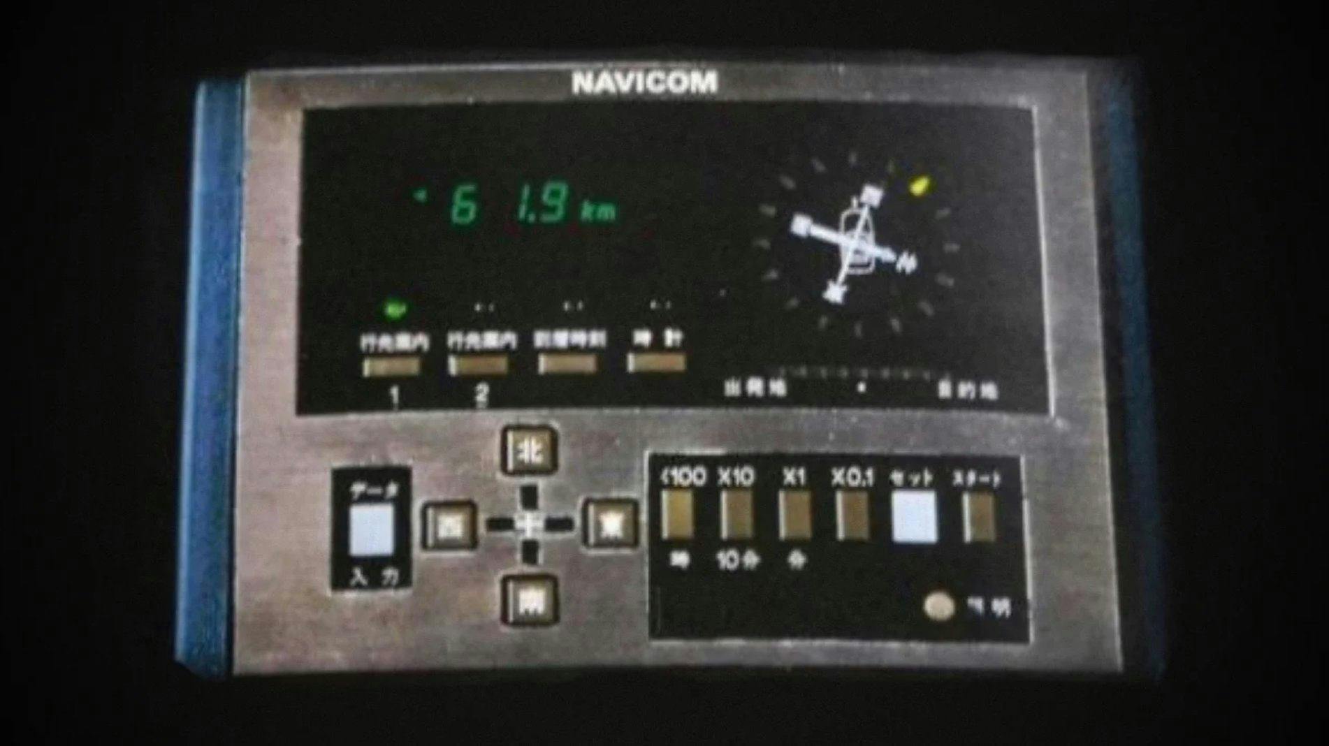
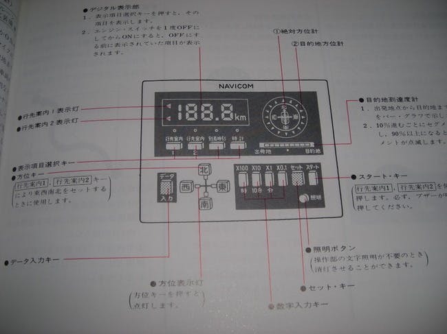
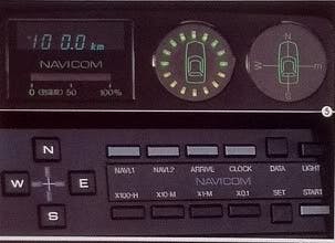
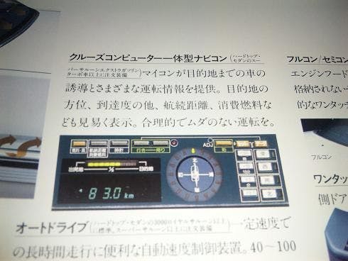
Toyota’s Navicom system was available on the 1981 Celica, and it appears to be along the same lines as Nissan’s effort. As Toyota put it in a press release, the Celica’s Navicom system was “designed to facilitate driving in unfamiliar areas through constant display of direction and distance to destination.”
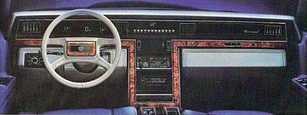
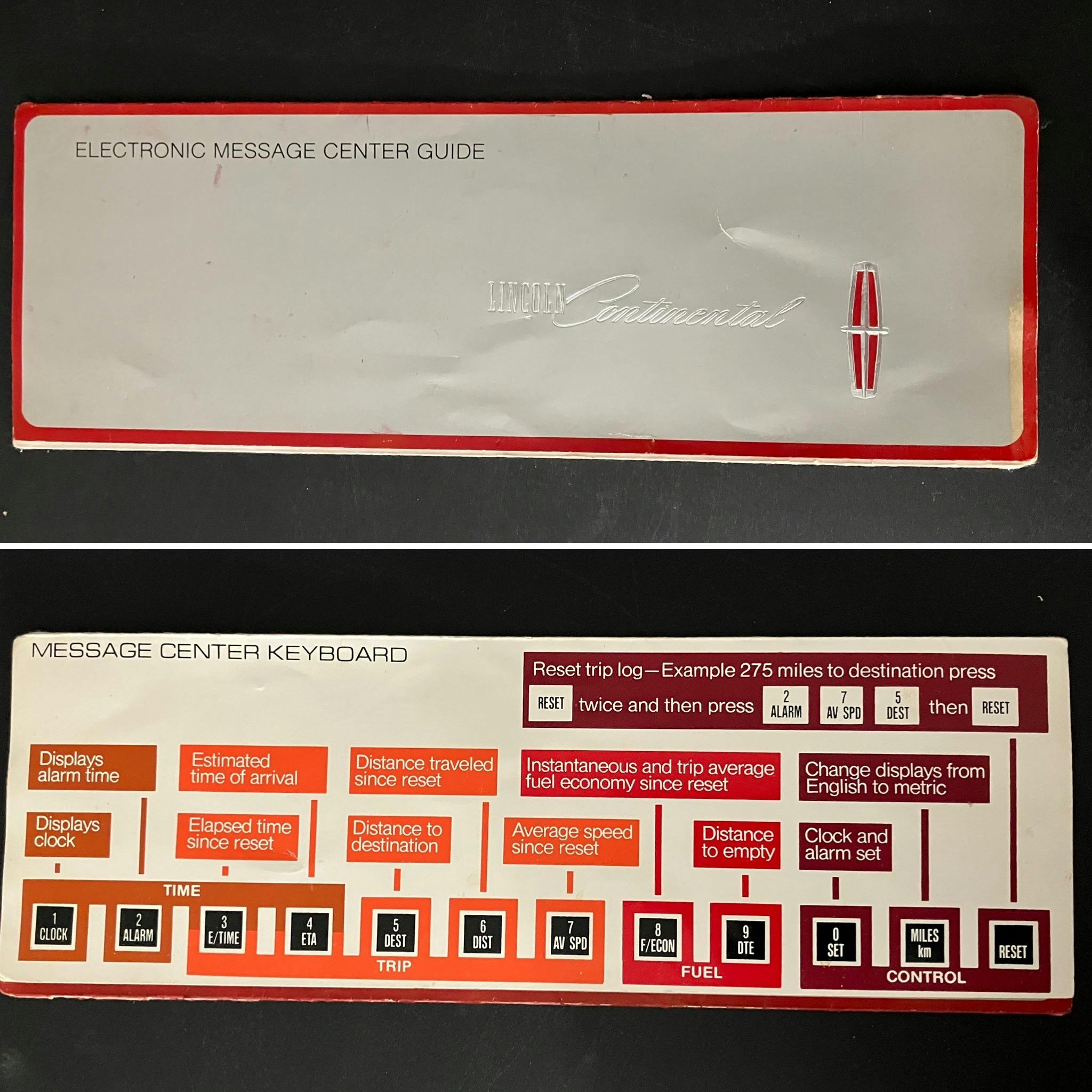
Users input their location and the distance required to travel, and Toyota’s Navicom gave them real-time information on their current direction (via ingenious compass graphic), distance remaining, and even the percentage of distance traveled. These systems are generally clueless by today’s standards, but trip computers from the likes of Lincoln and Cadillac were far less interesting and exciting to behold. Lincoln’s computer offered an Estimated Time of Arrival and more advanced fuel economy calculations, but buttons and owner’s manuals can’t top what Japan Inc.’s investment in in-car navigation created for the 1981 model year.
Satellite-based navigation systems, which would take this idea to the next level, were just around the corner. Ford was preparing a concept car with a NAVSAT-based system, but it probably saw Honda’s relative failure to launch; Ford even decided to pull the plug on a watered-down derivative to avoid getting burned. Toyota released the first CD-ROM-based navigation system in its Crown models for 1987, and it offered a modern-style GPS navigation system on the 1991 Soarer. Also in that year, General Motors piloted the TravTech navigation system in Oldsmobile Toronados rented to users in the Orlando area. The system even sported points of interest, a feature we come to expect from modern systems.
While modern technology seemingly progresses at a far faster pace now than it did in the 1980s, going from a Gyrocator and slide-in maps in 1981 to a fully-fledged GPS navigation system a decade later is nothing to sneeze at. By 1995, a system was available in Oldsmobile vehicles under the “Guidestar” name, either as a separate control panel in some models (like the Delta 88 LSS below) or as an integrated screen in the all-new Aurora. It’s good enough to merit the need for an absolutely cringe-worthy video.
Wow, that has not aged well. Apparently retailing in the 1990s wasn’t far off from the 1950s.
No matter. Decades of research in America and Japan, plus countless amounts of money spent indeed created something we can’t live without today. And just like the sales pitches (to all human beings in our diverse society), the technology behind navigation systems continues to improve as the years go by. But let’s never forget how pivotal of a role Japan Inc., and Honda in particular, played in making this dream into a reality for all of us.

